BALTIMORE — It will be quite hot and humid for the rest of this week.
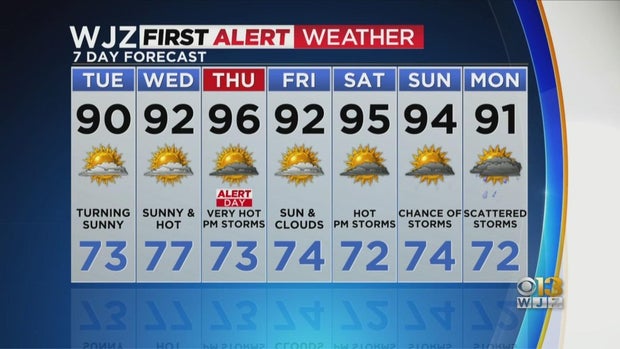
Plenty of sunshine ahead for today. Tuesday will be dry but hot with highs around 90.
On Wednesday and Thursday, the heat cranks up as westerly winds bring hot air into the region from the central US. In fact, this will be a prolonged period of 90° heat for the area, certainly the longest stretch we’ve seen this season.
The hottest day will be Thursday, with actual temps in the mid to upper 90s, but factored in with the humidity, it will feel like 100-105°.
Another cold front will move through the area Thursday with storm chances. That’s why Thursday is an Alert Day.
The heat continues Friday into the weekend, with Saturday seeing the hottest temps again in the mid-90s, with heat index values approaching 100.
More updates to come on WJZ and streaming on CBS Baltimore

