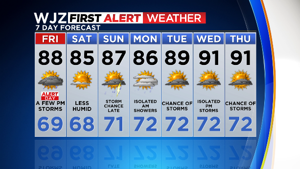
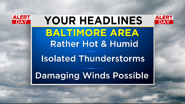
BALTIMORE — It’s shaping up to be yet another hot and humid day–and another Alert Day.
Our Friday is off to a relatively calm and comfortable start with mostly cloudy skies overhead.
With all of this heat and humidity, we’re looking at a high near 86 degrees this afternoon.
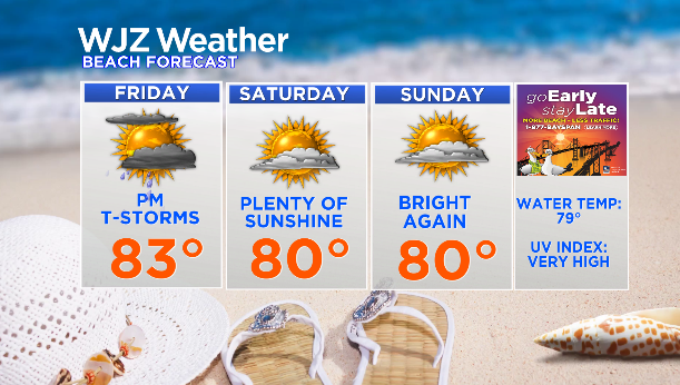
All bets are off after lunchtime when we could see scattered showers and a thunderstorm.
The moisture in the air will fuel heavy downpours, but the main threat is damaging winds.
But with downpours, there is potential for flooding in low-lying areas.
Most of the stronger storms are expected to stay south and east of the U.S. 50 corridor.
As we head into the evening, the potential for showers and thunderstorms will continue.
We expect things to stay cloudy this evening as temperatures outside cool off a bit.
But we anticipate a round of showers with a chance for a storm before 8 p.m.
We could also see another round of showers and thunderstorms between then and 2 a.m.
With a 60% chance for rain, we’re looking at totals between a tenth and quarter of an inch.
The forecast looks a little more promising over the weekend with diminishing humidity.
Saturday looks to be mostly sunny with an afternoon high in the mid 80s.
Then on Sunday, it will be a similar story but with a chance for storms late in the day.